3D model with contour lines and volume measurements.
Deliverables to the Client

Orthomosaic map of the construction site
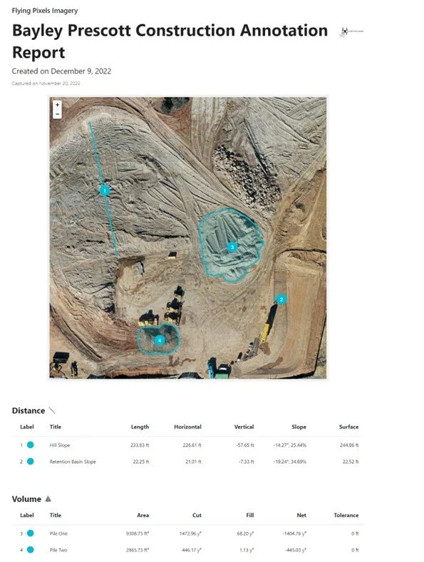
Annotation report, volumetrics, slope, distances, etc.

Digital Elevation Model


