Drone Mapping
Orthomosaic Maps
Our orthomosaic maps are accurate photo representation of an area, created from hundreds of photos that have been stitched together and geometrically corrected so that it is as accurate as a map.
Elevation Models
Digital Elevation Model is a representation of the Earth’s terrain elevation at specific locations. DEMs deliver a detailed representation to what the terrain is like, giving valuable information to the client.


Extreme high definition orthomosaic map (resolution limited for online preview)
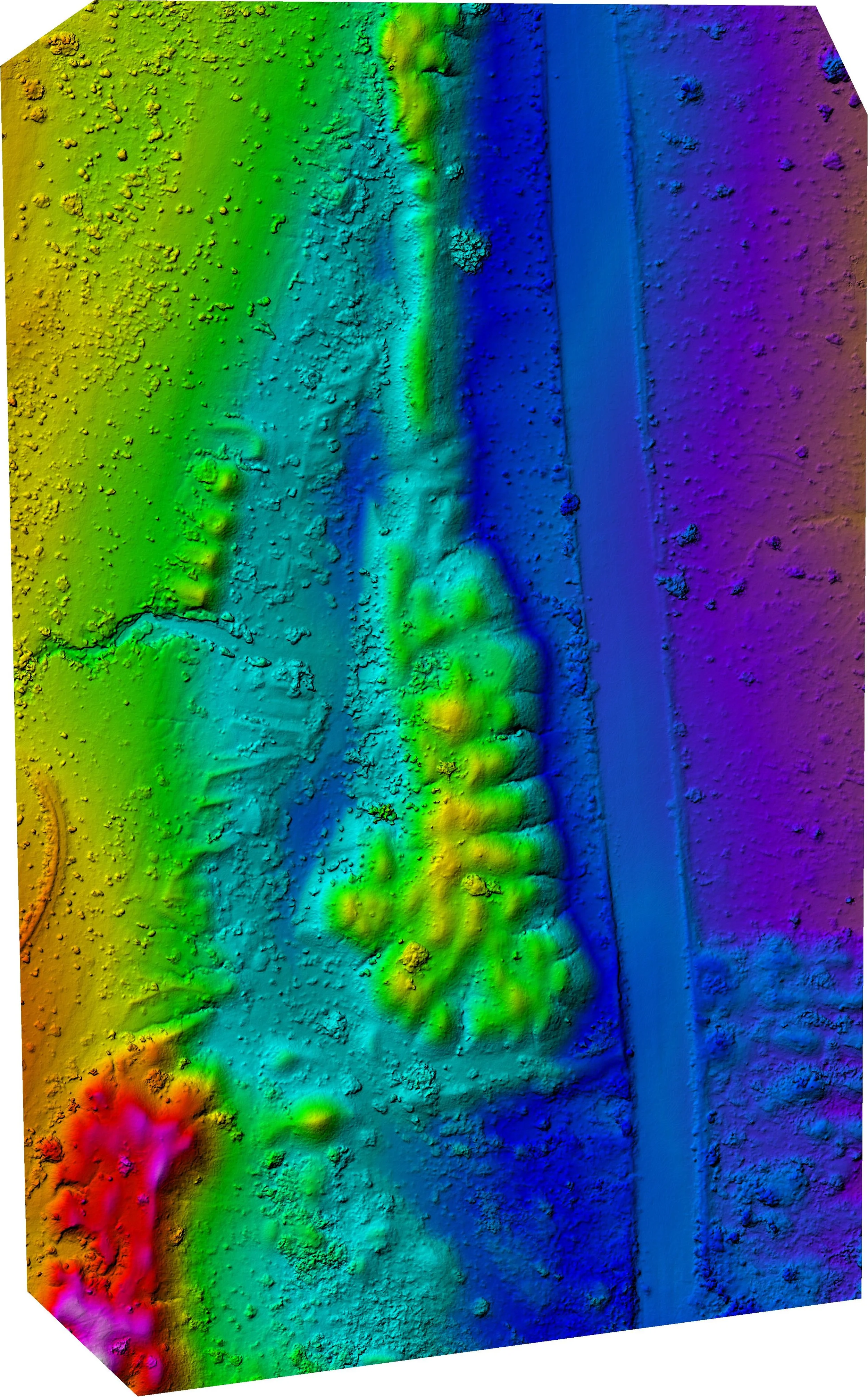
Digital Elevation Model (DEM)

Orthomosaic model over layed on most recent Google Satellite maps for quality comparison

Extreme high definition orthomosaic map (resolution limited for online preview)

Digital Elevation Model (DEM)

Orthomosaic model over layed on most recent Google Satellite. We were able to identify exact locations irrigation lines.